

Topographical and GPS Surveys
Send us your plan and brief, detailing your needs for an effective survey that takes into account all the factors that you require. Using our LSS software and outputting into AUTOCAD or MOSS, we create a plan of the area to help with the design of the development.
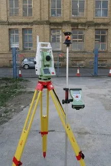
We use the latest equipment to ensure accuracy and reliability on all our surveys. GPS is used to coordinate the site for compatibility with Ordnance Survey and the level datum in line with Enviromental Agency guide lines.
The list below is the areas of survey work we undertake.
Topographical Area Survey List
-
Green Field Surveys.
-
Commercial Land and Development
-
Retail Development
-
Residential Development
-
Area and Volume Calculations
-
Boundary Disputes
-
Underground Service Mapping (third party)
-
Flood Risk Surveys
You can find examples of Topographical and GPS Surveys in the Gallery.
Anchor House, Dewsbury
Big-Name Customers
From Asda™ to Morrisons™, Ellam Land Surveys have worked with many prestigious clients. We’ve helped many regional councils with their needs, including Kirklees and Wakefield. Other clients include:
Topographical Big-Name Customers List
-
Leeds Council
-
Evand of Leeds
-
Westfield Shopping Centres
-
White Young Green
-
WCEC Architects
-
Dransfield Properties
-
DLA Architecture
-
Marshalls / Building Management Services
Contact Ellam Land Surveys for a detailed Topographical Survey of any area you need.